- News
News:LEO land use map moves to next stage
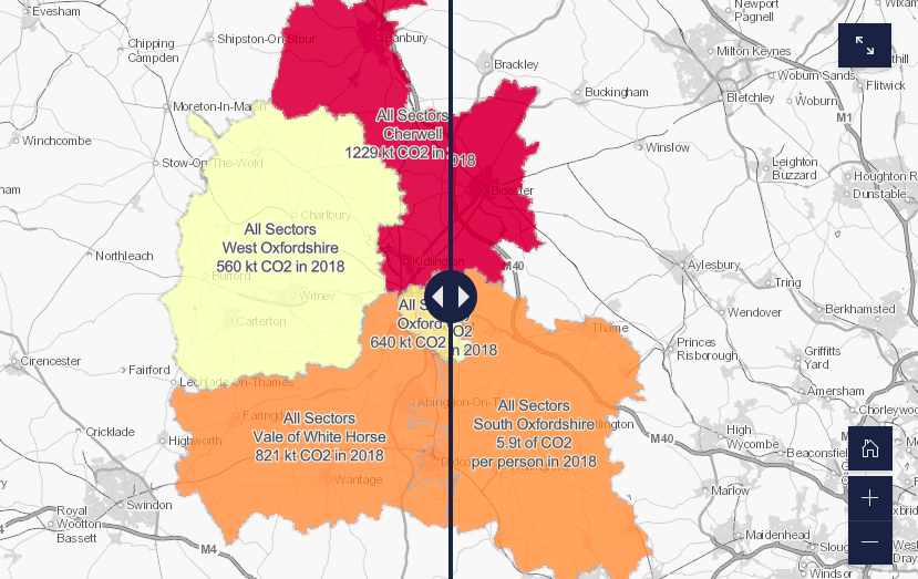
The LEO land use map draws together a wide range of energy and land use data into a single web-based map currently available to LEO partners. Knowing where energy is used and generated across the county, and where we’re most likely to see changes over time will help support strategic place-based planning for the transition… - News
News:Innovative new data sharing tool being trialled by LEO
Project LEO partner Scottish and Southern Electricity Networks (SSEN) has launched a new and innovative network data tool which will be trialled by the project. The ‘Near Real-time Data Access’ (NeRDA) tool will provide stakeholders and participants in LEO’s trials with near real-time access to data, helping inform local plans, products, and services in the…